Image from NOAA—Sound Credit
Play this page as a M3U playlist
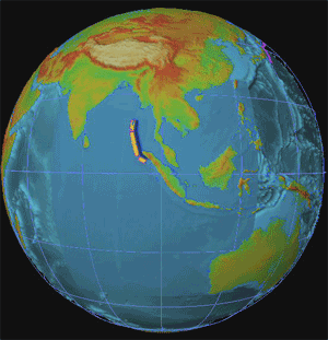
Based on the location of aftershocks, the United States Geological Survey reports that approximately 1,200 kilometers of the plate boundary probably slipped as a result of the quake. The initial rupture was likely more than 100 kilometers wide, and probably produced an average vertical displacement along the fault plane (the slope along which the two plates meet) of 15 meters.
When the bottom of the ocean is deformed by this type of “megathrust” quake, the upward force acts like a fist rising up from underwater. Water rolls down off the sides of the “fist,” creating massive waves that can travel as fast as an airplane. The waves can move across the ocean and barely disturb the surface, but when they reach shallow coastal water, the earthquake’s energy thrusts them tens of meters into the air.—Earthquake Spawns Tsunamis
Analysis of the seismic record reveals that the earthquake was the end product of the rupture of a 1,200km length of the boundary between the Indo-Australian and Burma tectonic plates. Preliminary analysis suggests that the rupture travelled at a rate of about 2km a second, but not in one go.
It looks as if the first phase involved the formation of a rupture about 400 km long and 100km wide and just 30km beneath the sea bed. The rupture tore the crust in a north-westerly direction, beginning off the west coast of northern Sumatra's Aceh province, and took just one minute and 40 seconds to form. After a pause of similar length, the rupture continued northwards for another several hundred kilometres, beneath the Andaman and Nicobar Islands.—Reading between the lines
2004 Indian Ocean earthquake
Based on one seismic model, some of the smaller islands southwest of Sumatra have moved southwest up to 20 m (66 ft). The northern tip of Sumatra, which is on the Burma Plate as opposed to the southern regions on the Sunda Plate, may also have moved southwest up to 36 m (120 ft). Other models suggest that most of the movement would have been vertical rather than lateral. Further measurement is needed to determine the nature of the actual movement. The massive release of energy and shift in mass also caused the earth to rotate 1/10,000th of a second faster.
The earthquake was unusually large in geographical extent. An estimated 1200 km (750 miles) of faultline slipped about 15 m (45 ft) along the subduction zone where the India Plate dives under the Burma Plate. The slip did not happen instantaneously but took place in two phases over a period of several minutes. Seismographic data indicate that the first phase involved the formation of a rupture about 400 km long and 100 km wide, located 30km beneath the sea bed. The rupture proceeded at a speed of about 2 km/s, beginning off the coast of Aceh and proceeding north-westerly over about 100 seconds. A pause of about another 100 seconds took place before the rupture continued northwards towards the Andaman and Nicobar Islands.
As well as the sideways movement between the plates, the sea bed is estimated to have risen by several metres, triggering devastating tsunami waves. The tsunami did not originate from a point source, as mistakenly depicted in many illustrations of their spread, but radiated outwards along the entire 1200 km length of the rupture. This greatly increased the geographical area over which the waves were observed, reaching as far as Mexico and Chile.
The total energy released by the earthquake in the Indian Ocean has been estimated as 2.0 exajoules (2.0×10¹⁸ joules). This is enough to boil 150 litres (40 US gallons) of water for every person on Earth. It is estimated to have resulted in an oscillation of the Earth's surface of about 20 to 30 cm, equivalent to the effect of the tidal forces caused by the Sun and Moon. The shock waves of the earthquake were felt across the planet—as far away as Oklahoma, vertical movements of 0.12 in (3 mm) were recorded.
The shift of mass and the massive release of energy very slightly altered the Earth's rotation. The exact amount is yet undetermined, but theoretical models suggest the earthquake shortened the length of a day by 2.68 microseconds (2.68 µs) (or about one billionth of the length of a day) due to a decrease in the oblateness of the Earth. It also caused the Earth to minutely "wobble" on its axis by up to 2.5 cm (1 inch) in the direction of 145° east longitude, or perhaps by up to 5 or 6 cm. However, due to tidal effects of the Moon, the length of a day increases at an average of 15 µs per year, so any rotational speedup due to the earthquake will be quickly lost. Similarly, the natural Chandler wobble of the Earth can be up to 15 m (50 ft).
Sumatra Quake Shook Earth's Total Surface
The quake occurred where two of the giant plates that form the surface of the Earth grind together.
At that spot the Eurasian plate was being pulled downward by the descending Indo-Australian plate. The quake released the edge of the Eurasian plate, which sprang up, lifting the ocean floor and sending the sea water off in the giant wave that killed so many, the researchers reported.
They said the higher sea floor displaced so much water from the Bay of Bengal and the Andaman Sea that sea level worldwide was raised 0.004 inch.
"No point on Earth remained undisturbed," wrote Roger Bilham of the University of Colorado.
Indeed, ground movement of as much as 0.4 inch occurred everywhere on Earth's surface, though it was too small to be felt in most areas.
And the temblor "delivered a blow to our planet" that was felt for weeks, noted a team of researchers led by Jeffrey Park of Yale University.
His group calculated that the quake caused the planet to oscillate like a bell, at periods of about 17 minutes, which they were able to measure for weeks afterward. A similar phenomenon was first noted in the 1960 quake in Chile...
Among the other findings reported in the various papers:
- In Sri Lanka, more than 1,000 miles from the epicenter, the ground moved nearly 4 inches.
- The rupture spread from south to north, resulting in a Doppler effect in instruments measuring it. Seismometers in Russia recorded the quake at a higher frequency because it was moving toward them, while those in Australia measured a lower frequency as it moved away.
- When the surface waves from the Sumatra quake reached Alaska they triggered a swarm of 14 local earthquakes in the Mount Wrangell area.
I have to tell you that the spheroid is now a little less oblate, gentlemen...
Using some of the world's most sensitive gravitational measuring equipment at an observatory near Canberra, the scientists detected oscillations equivalent to a millimetre of the earth's vertical movement. Immediately after the quake, the oscillation was probably in the 20-to-30cm motion range typically generated in the earth by the movements of the sun and moon, researchers said.
In Virginia, the earthquake shifted water levels by at least three ft in a geologically sensitive well around 9600 miles from the epicentre. The well, which is monitored by the US Geological Survey as it is particularly sensitive to movements in the earth, started oscillating about an hour after the earthquake.
NASA scientists have also calculated that the earthquake slightly changed our planet's shape, shaved almost 3 microseconds from the length of the day, and shifted the North Pole by centimetres.
According to their latest calculations, the Dec. 26th earthquake shifted Earth's "mean North Pole" by about 2.5 centimetres in the direction of 145 degrees east longitude, more or less toward Guam in the Pacific Ocean. This shift is continuing a long-term seismic trend identified in previous studies. The quake also affected Earth's shape. Chao and Gross calculated that Earth's oblateness (flattening on the top and bulging at the equator) decreased by a small amount—about one part in 10 billion. This continues the trend of earthquakes making Earth less oblate. Less oblate means more round.
They also found the earthquake decreased the length of the day by 2.68 microseconds. (A microsecond is one millionth of a second.) In other words, Earth spins a little faster than it did before. This change in spin is related to the change in oblateness.
The Sound of a Distant Rumble
When an earthquake occurs underwater, part of its energy is released in the form of sound, known as a tertiary or T wave, which travels great distances through the ocean...The T waves for the Sumatra earthquake were captured by underwater microphones located at Diego Garcia, more than 1,700 miles from the epicenter. These microphones are part of arrays known as hydroacoustic stations that are scattered throughout the world's oceans to listen for the telltale sound of an atomic blast.—The Sound of a Distant Rumble
Play this page as a M3U playlist
|
|
How Can Animals Predict Earthquakes?
Relief
|
